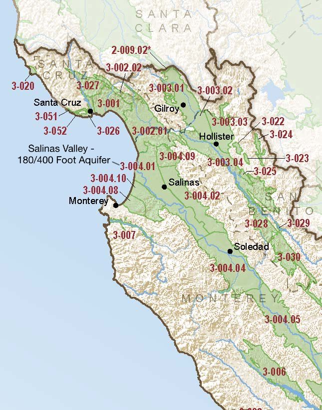
Salinas Valley – 180/400 Foot Aquifer
Statistics
- Basin Name
- Salinas Valley – 180/400 Foot Aquifer
- Basin Number
- 3-004.01
- SGMA Basin Priority
- High
- Critically Overdrafted
- Yes
- Hydrologic Region Name
- Central Coast
- Counties
- Monterey
Basin Notes
2003: Bulletin 118 basin description
2016: Major basin boundary modifications part of collective changes to the Santa Cruz Purisima formation 3-021, Pajaro Valley 3-002 and Salinas Valley – Langley Area 3-004.09 boundaries. Per 2016 Interim Bulletin 118 update: Various portions of the original Pajaro Valley Basin were moved to three adjacent subbasins/basins—180/400 Foot Aquifer Subbasin (3-004.01), Langley Area Subbasin (3-004.09), and the newly formed Santa Cruz Mid-County (3-001) Basin. A portion of the former Santa Cruz Purisima Formation Basin (3-21) was added to this basin. The Pajaro Valley Basin was also reclassified as a subbasin. A portion of the original 180/400-Foot Aquifer subbasin was moved to the Pajaro Valley Subbasin (3-002.01).
2016: Revised basin boundary description
2018: Basin prioritization comments:
-
- Declining groundwater levels: 1) CASGEM/WDL/GWIDS: Longterm hydrographs show groundwater level decline. Source: DWR 2) “In most of the subareas, were seeing historic lows, said MCWRA senior hydrologist Howard Franklin, adding that he expects new data to show that underground seawater intrusion into the basin, which slowed in recent years, has restarted its march down the valley. – Santa Cruz Sentinel
- Salt intrusion: 1) Seawater intrusion began in the Salinas Valley by the 1930s. Since that time, seawater intrusion has continued and now extends more than five miles inland. The Monterey County Flood Control and Water Conservation District built Nacimiento Dam in 1957 and an Antonio Dam in 1965 to provide flood control and to accelerate groundwater recharge to mitigate seawater intrusion. In April 1998, the Monterey County Water Recycling Projects started delivering recycled water for irrigation in lieu of groundwater pumping, effectively slowing the seawater intrusion rate (MCWRA, 2006). – Central Coast Groundwater: Seawater Intrusion and Other Issues, California Water Foundation, 2014 2) The Salinas Valley Water Project is currently being implemented by the Monterey County Water Resources Agency to mitigate groundwater overdraft and seawater intrusion. The project includes mitigation measures such as construction or retrofit of recharge dams, protection of recharge areas, and injection of recycled water into the impacted aquifers.
2018 Final Basin Prioritization: Basin status is unchanged at High.
2020:
- January 23: Collective GSP from Salinas Valley Basin GSA – 180/400 Foot Aquifer, Salinas Valley Basin GSA – 180/400 Foot Aquifer and County of Monterey GSP filed with DWR
2021: June 3 — GSP approved by DWR
2022: annual reports here
At-A-Glance
California Water Library Documents About This Basin
2024 Annual Multibenefit Land Repurposing Program Report
California Department of Conservation (CDoC) | May 29th, 2025
The Multibenefit Land Repurposing Program (MLRP) increases regional capacity for repurposing irrigated agricultural land to uses that reduce reliance on groundwater while
Application of Hydrologic Simulation Program—FORTRAN (HSPF) as Part of an Integrated Hydrologic Model for the Salinas Valley, California
U.S. Geological Survey (USGS) | April 8th, 2025
The U.S. Geological Survey (USGS), in cooperation with the Monterey County Water Resources Agency, conducted studies to help evaluate the surface-water and grou
Salinas Valley Integrated Hydrologic and Reservoir Operations Models, Monterey and San Luis Obispo Counties, California
Monterey County Resources Agency (MCRA) | April 5th, 2025
To evaluate the challenging water management issues in the Salinas Valley, the U.S. Geological Survey, Monterey County Water Resource Agency, and the Salina
Multibenefit Land Repurposing Program Annual Report 2023
California Department of Conservation (CDoC) | April 9th, 2024
The Multibenefit Land Repurposing Program (MLRP) increases regional capacity for repurposing irrigated agricultural land to uses that reduce reliance on groundwat
Establishing ecological thresholds and targets for groundwater management
Nature Portfolio (Springer Nature) | April 3rd, 2024
Groundwater is critical for many ecosystems, yet groundwater requirements for dependent ecosystems are rarely accounted for during water and conservation planning. Here w
LandFlex Program’s Guidelines
California Department of Water Resources (DWR) | December 8th, 2022
LandFlex is a program that will provide $25 million in block grants to local government agencies to grant to farmers who limit agricultural water use. Local government ag
Statement of Findings regarding the Approval of the 180/400 Foot Aquifer Subbasin Groundwater Sustainability Plan
California Department of Water Resources (DWR) | June 3rd, 2021
Salinas Valley Groundwater Basin 180/400-Foot Aquifer Subbasin Groundwater Sustainability Plan
Salinas Valley Basin Groundwater Sustainability Agency | January 3rd, 2020
The 2014 California Sustainable Groundwater Management Act (SGMA) requires that medium and high-priority groundwater basins and subbasins develop Groundwater Sustainabil
Integrated Regional Water Management Plan for the Greater Monterey County Region
Greater Monterey County Regional Water Management Group | August 31st, 2018
Integrated regional water management (IRWM) is an approach to water resource management in California that is being strongly promoted by the State as a way to inc
2017 Salinas Valley Groundwater Level Contours & Seawater Intrusion Maps
Monterey County Water Resources Agency (MCWRA) | April 24th, 2018
A multi-isotope (B, Sr, O, H, and C) and age dating (3H–3He and14C) study of groundwater from Salinas Valley, California: Hydrochemistry, dynamics, and contamination processes
American Geophysical Union (AGU) | January 31st, 2002
The chemical and isotope (11B/10B, 87Sr/86Sr, 18O/16O, 2H/H, 13C/12C, 14C, and 3He/3H) compositions of groundwater from the upper aquifer system of the Salinas Valley in
A Water Resources Data Network Evaluation for Monterey County, California; Phase 3, Northern Salinas River Drainage Basin
U.S. Geological Survey (USGS) | December 13th, 1990
Continuing data collection and analysis are vital to efficient development and management of water resources. To insure that water managers have adequate information on c
Bulletin 118: California's Groundwater (1980)
California Department of Water Resources (DWR) | January 1st, 1980
Ground water management is a major issue in California. The Governor's Commission to Review California Water Rights Law, in its December 1978 report, recommends a new g
Water Supply Conditions in Southern California during 1958-1959, Volume II, Water Level Data, Central Coastal and Los Angeles Regions
California Department of Water Resources (DWR) | May 1st, 1961
Bulletin No. 39-58, Water Supply Conditions in Southern California during 1957-1958, Volume II, Precipitation and Water Level Data, Central Coastal and Los Angeles Regions
California Department of Water Resources (DWR) | August 1st, 1960
Bulletin No. 39-57, Water Supply Conditions in Southern California during 1956-1957, Volume II, Precipitation and Water Level Data Central Coastal and Los Angeles Regions
California Department of Water Resources (DWR) | June 16th, 1958
Bulletin No. 39-57 Volume I Bulletin No. 39-57 Volume III Bulletin No. 39-57 Volume IV