Rewilding California farms: grants going out to repurpose drought-parched Central Valley land

From CBS Bay Area:

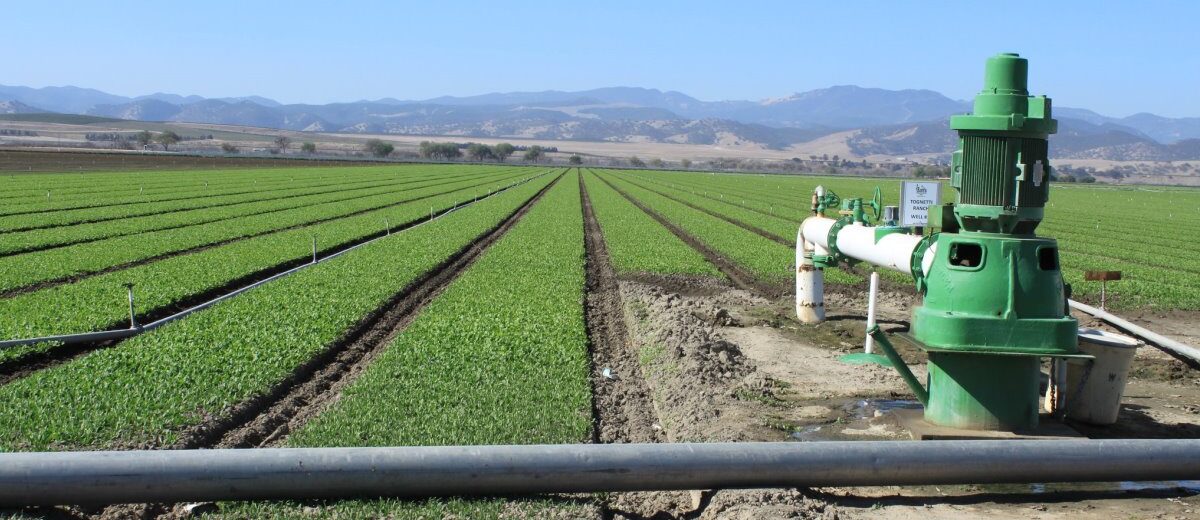
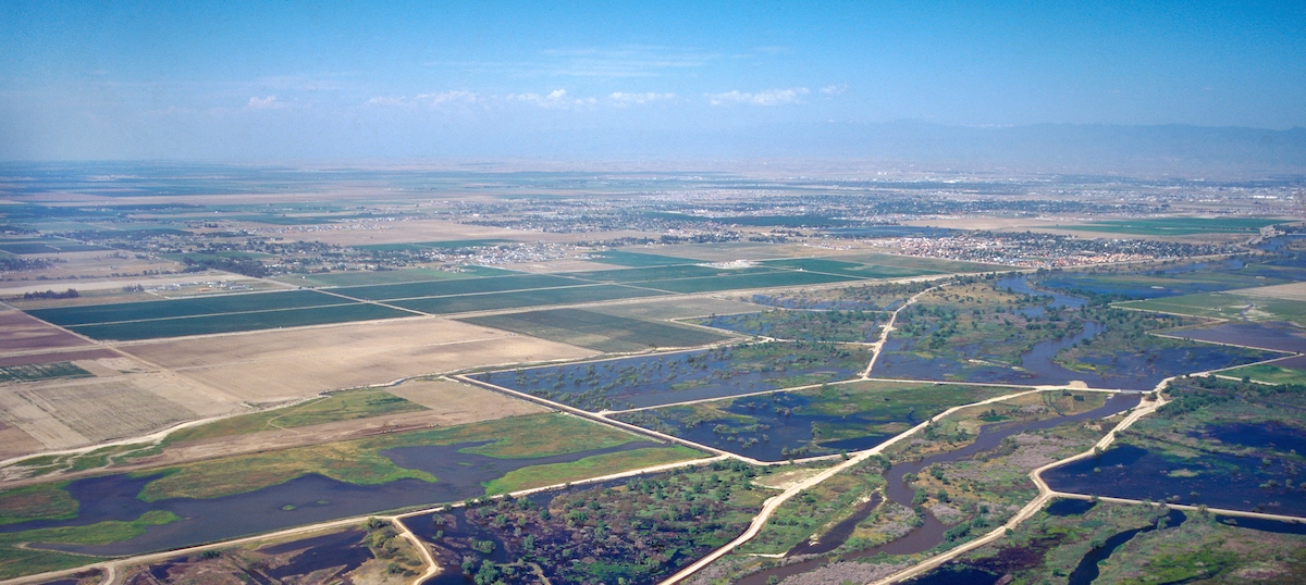
“A withered cornstalk may become the near-future snapshot of some farms in the drought-stricken Central Valley, while also allowing the return of a native landscape that will help conserve the state’s water.  The Federal Central Valley Project is not expected to send any water to most farmers who work the fields as California enters a third year of drought.

“I always say we’re a poster child for this issue, because we’re not doing it right,” said Mike Hagman, executive director of the Lindmore Irrigation District, located in the Tulare County city of Lindsay. … Hagman owns 160 acres of now-fallowed agricultural land. But now there is some hope. His land and others may find a new life under an innovative $50 million California project.  … ”

Read more from CBS 5 here: Rewilding California farms: grants going out to repurpose drought-parched Central Valley land

SEE ALSOSome California farmland being restored to natural state in hopes of lessening drought effects, from CBS News

Stanford study finds subsidence likely to continue even if groundwater stops declining

From Stanford News:

The floor of California’s arid Central Valley is sinking as groundwater pumping for agriculture and drinking water depletes aquifers. A new remote sensing study from Stanford University shows land sinking – or subsidence – will likely continue for decades to centuries if underground water levels merely stop declining. To stop the sinking, water levels will need to rise.

“If you don’t get these water levels to come back up, then the land is going to sink, potentially tens of centimeters per year, for decades. But if they go up, you can get rewarded very quickly. You almost immediately improve the situation,” said Matthew Lees, a geophysics PhD student and lead author of the study, which appears June 2 in Water Resources Research.

Click here to continue reading at Stanford News.


OpenET: A Transformative Tool for Tracking Water in the U.S. West

Openet is a satellite-based data resource supplying crucial water use information in 17 Western U.s. States.

Using the best available science to provide easily accessible satellite-based estimates of water use, OpenET is being used to improve U.S. water management. The data is available on 17 western states, most notably the area covered by the Colorado River basin.

The “ET” in OpenET stands for evapotranspiration, which is the process through which water leaves plants, soils, and other surfaces and returns to the atmosphere. It’s a measurement that farmers can use to estimate the amount of water being taken up or used by their fields and crops and that will usually need to be replaced through irrigation or rainfall.

Click here to read more from NASA.

California Spent Decades Trying to Keep Central Valley Floods at Bay. Now It Looks to Welcome Them Back

Land and waterway managers labored hard over the course of a century to control California’s unruly rivers by building dams and levees to slow and contain their water. Now, farmers, environmentalists and agencies are undoing some of that work as part of an accelerating campaign to restore the state’s major floodplains.

Click here to read this article from Western Water.

Q/A – Paul Gosselin, Deputy Director of Sustainable Groundwater Management

Below is an interview with DWR’s newly appointed Deputy Director of Sustainable Groundwater Management Paul Gosselin. Paul is a long-time water industry professional in California who will now lead the Department’s SGMO Office in implementing the State’s historic Sustainable Groundwater Management Act (SGMA).

What is your role with DWR and what excites you about the position?

The people and problem solving are two of the main things that excite me about working at the California Department of Water Resources (DWR). I joined DWR in July of 2021 as Deputy Director of Sustainable Groundwater Management.

A critical part of my position is overseeing the Department’s review of local groundwater sustainability plans as part of the Sustainable Groundwater Management Act (SGMA). The effort to advance local programs to sustain groundwater resources is among one of the most important decisions facing California today.

Continue reading at DWR News by clicking here.

A Test for California’s Groundwater Regulations in the Megadrought

California’s megadrought has brought forth competition for scarce water supplies. Brownstein Hyatt shareholder Stephanie Osler Hastings examines implementation of the California Legislature’s first comprehensive groundwater regulation to deal with the issue, enacted in 2014, in this context. She also looks at recent challenges to these rules.

Click here to read the article from Bloomberg Law.

Ancient River Channels Could Speed Groundwater Recharge

By the time California finally began regulating groundwater use in 2014, most of the San Joaquin Valley was in critical overdraft. The Public Policy Institute of California estimates that groundwater pumping in the region has exceeded replenishment by an average of 1.8 million acre-feet per year over the last few decades. This imbalance was even worse during our last drought, when overuse shot up to 2.4 million acre-feet per year.

Overpumping puts groundwater aquifers at risk of compaction, permanently reducing their water storage capacity and making surface lands sink. Now, however, San Joaquin Valley groundwater managers must find and implement a fix. The state’s Sustainable Groundwater Management Act mandates balancing the region’s pumping with replenishment by 2040.

Managed aquifer recharge — diverting excess flood water so it can soak into the ground — is an obvious remedy. But accelerating recharge in the San Joaquin Valley is easier said than done. “Recharge is slow in silt and clay, and these are ubiquitous across the Central Valley,” explains Graham Fogg, an emeritus hydrogeologist at UC Davis.

Fogg and colleagues have found a new way to speed recharge in the Central Valley: ancient river channels where water can shoot underground.

Click here to continue reading this article at Estuary News.

Click here to visit the Groundwater Exchange’s news page.

The end of California’s groundwater free-for-all

“The water spigots on California farms will soon be twisted tighter.

As the state faces a growing threat from drought, an increasing number of water agencies are planning to require flow meters on agricultural wells, part of a landmark effort to measure and constrain pumping that used to be free and unlimited. It’s a controversial step aimed at protecting water supplies that could change cultivation practices in the Golden State’s thirsty fields.

“It’s hard to be as efficient as possible if you don’t know how much water you’re using,” said Sierra Ryan, interim water resources manager for Santa Cruz County.

Under the state’s tough new groundwater protection law, “we now have a legal obligation to manage our groundwater sustainably,” she said. “And we cannot manage the basin with such large uncertainties in our water use.” ... ”

Click here to continue reading this article at the San Jose Mercury News.

Click here to visit the Groundwater Exchange’s news page.

How ‘sustainable’ is California’s groundwater sustainability act?

From High Country News:

Beneath the almond and citrus fields of the San Joaquin Valley lies an enormous system of aquifers that feeds some of the world’s most productive farmland. Hundreds of miles north and east, along the Nevada border, is the Surprise Valley, a remote, high-desert region undergirded by cone-shaped hollows of sediment that hold deposits of water. Both of these water systems, along with every other groundwater basin in California — a whopping 515 entities — must create individually tailored plans to manage their water use more sustainably. In scale and ambition, California’s Sustainable Groundwater Management Act (SGMA) has few parallels. And the work becomes increasingly urgent as the climate crisis makes water shortages increasingly severe.

Passed in 2014, SGMA is a complicated law that addresses what appears to be a straightforward problem: California doesn’t have enough groundwater. For decades, water users have taken out more than they put back in, with little statewide oversight. SGMA changes all that by drawing boundaries around the state’s groundwater basins (some, but not all, had been already defined and locally regulated) and requiring each one to create a local regulatory body and its own sustainability plan. These agencies must work with myriad stakeholders — public water systems, Indigenous nations, domestic and municipal well users and historically disadvantaged communities, as well as the ecosystems themselves.

Click here to continue reading this article from the High Country News.

PRESS RELEASE: State Water Agencies, CA Water Data Consortium and EDF Partner on Groundwater Accounting Platform and Data Standards

State water agencies, the California Water Data Consortium (Consortium) and Environmental Defense Fund (EDF) announced a new partnership today to make an open-source groundwater accounting platform freely available to help groundwater sustainability agencies manage the transition to sustainable supplies.

Collaborative efforts are underway among the Department of Water Resources (DWR), the State Water Resources Control Board (Water Board), the Consortium and EDF to adapt and scale the groundwater accounting platform that was co-developed by EDF and Rosedale-Rio Bravo Water Storage District with technical support from Sitka Technology Group, OpenET, WestWater Research, and Olsson Engineering and funding from the Water Foundation, among other supporters. Use of the groundwater accounting platform is entirely voluntary.

“Our goal is to help groundwater managers more easily and cost-effectively track water use across their agencies and coordinate within and across basins to find the most effective approach for enabling sustainable groundwater management,” said Steven Springhorn, acting deputy director at DWR for statewide groundwater management. “The accounting platform developed by EDF is a valuable tool for local decision making, and the Water Data Consortium is a natural fit for ensuring the platform meets local and state needs long term.”

Click here to continue reading this press release from the Department of Water Resources.

SEE ALSO: 3 ways this accounting platform will help California groundwater agencies transition to sustainable supplies, from the Growing Returns blog