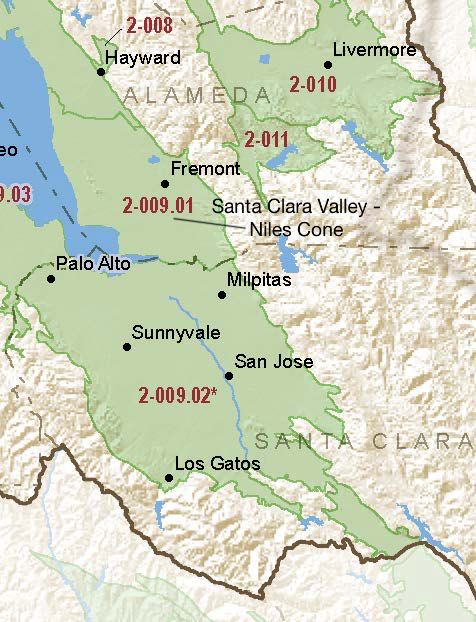
Santa Clara Valley – Niles Cone
Statistics
- Basin Name
- Santa Clara Valley – Niles Cone
- Basin Number
- 2-009.01
- SGMA Basin Priority
- Medium
- Critically Overdrafted
- No
- Hydrologic Region Name
- San Francisco Bay
- Counties
- Alameda
Basin Notes
2003: Bulletin 118 basin description
2014: Basin Prioritization notes: Saline water intrusion has increased landward and into deeper aquifers since first documented in the 1920’s.(B-118) GW Use based on B118-03 data. GW percentage is updated based on PubCom.
2016: Basin boundary modification with Santa Clara Valley – East Bay Plain 2-009.04
December 31– Existing Alternative to GSP submitted to DWR
2018: Draft basin prioritization comment – Declining groundwater levels and salt intrusion: East Bay Municipal Utility District service area: San Ramon, Richmond (between San Pablo Bay and Berkeley), Ygnacio and Clayton Valley, Castro Valley, and South East Bay Plain (Niles Cone borders East Bay Plain basin on south) basins. The basins have similar morphology and a Mediterranean climate. All are structural depressions formed by folding and faulting, all are filled with marine and alluvial sediments, and all are drained by streams that contain water at least part of the year. Seawater intrusion is common. Groundwater use in the East Bay Municipal Utility District service area is limited by several factors, including the effects of saltwater intrusion and contamination in shallow aquifers on groundwater quality and the availability of higher quality imported surface water. Groundwater is currently not used by East Bay Municipal Utility District for municipal supplies. Alameda County Water District provides retail water supplies to the cities of Fremont, Newark, and Union City. The district has implemented treatment of brackish groundwater to allow previously unused groundwater to be used as a potable water source (ACWD 2011, 2012). In 2003, the Alameda County Water District Newark Desalination Facility began to remove salts and other constituents from the Niles Cone subbasin groundwater that is subject to seawater intrusion using a reverse-osmosis process. Source: Long-Term Operation EIS, Chapter 7, pg 7-56, U.S. Bureau of Reclamation (USBR), 2015 2018 Final Basin Prioritization: Basin status is unchanged at medium priority.
2019: July 17 – Alternative approved by DWR
2024: June 27 – Review of Alternative by DWR — approval
At-A-Glance
California Water Library Documents About This Basin
Statement of Findings Regarding the Periodic Review and Approval of the Santa Clara Valley – Niles Cone Subbasin Alternative Groundwater Sustainability Plan
California Department of Water Resources (DWR) | June 27th, 2024
Statement of Findings Regarding the Approval of the Santa Clara Valley - Niles Cone Subbasin Alternative Groundwater Sustainability Plan
California Department of Water Resources (DWR) | July 17th, 2019
Groundwater Quality in the San Francisco Bay Groundwater Basins, California
U.S. Geological Survey (USGS) | March 29th, 2013
Status and Understanding of Groundwater Quality in the San Francisco Bay Groundwater Basins, 2007: California GAMA Priority Basin Project
U.S. Geological Survey (USGS) | March 29th, 2013
Groundwater quality in the approximately 620-square-mile (1,600-square-kilometer) San Francisco Bay study unit was investigated as part of the Priority Basin Project of t
Hydrogeology and Geochemistry of Aquifers Underlying the San Lorenzo and San Leandro Areas of the East Bay Plain, Alameda County, California
U.S. Geological Survey (USGS) | June 7th, 2003
Bulletin No. 81 Intrusion of Salt Water into Ground Water Basins of Southern Alameda County
California Department of Water Resources (DWR) | December 31st, 1960
Bulletin No. 39-Q, South Coastal Basin Investigation, Ground Water Levels and Precipitation Records in Los Angeles, San Gabriel and Santa Ana River Basins and Antelope Valley and Water Supply Summary for Southern Portion of California 1948
California Department of Water Resources (DWR) | July 1st, 1953