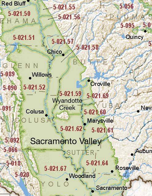
Sacramento Valley – Wyandotte Creek
Statistics
- Basin Name
- Sacramento Valley – Wyandotte Creek
- Basin Number
- 5-021.69
- SGMA Basin Priority
- Medium
- Critically Overdrafted
- No
- Hydrologic Region Name
- Sacramento River
- Counties
- Butte
- Adjacent Basins
Basin Notes
2016: Formerly part of the North Yuba subbasin, Wyandotte Creek was formed when DWR split the basin along the Butte-Yuba county line (October 2016).
2018: Draft basin prioritization – medium. Comment: 1) CASGEM/WDL/GWIDS: No data or data insufficent to determine GWL status. Source: DWR 2) Hydrographs shown in Yuba County Water Agency North Yuba Subbasin Boundary Modification Proposal are stable. Butte County basin boundary modification request by East Butte subbasin 5-021.69 to alter border pending Butte County basin boundary/consolidation request for Wyandotte Creek and the Corning 5-021.51, Colusa 5-021.52, Vina 5-021.57, West Butte 5-021.58, East Butte 5-021.59, Sutter 5-021.62 subbasins pending
2019: Basin boundary modifications. Phase 2 draft basin priority: medium
2022: January 28 – Groundwater Sustainability Plan (GSP) submitted to Department of Water Resources (DWR)
2023: GSP approved by DWR
At-A-Glance

California Water Library Documents About This Basin
Assessing Causes and Consequences of Winter Surface Water Dynamics in California's Central Valley Using Satellite Remote Sensing
Wiley Online Library | June 3rd, 2025
California's Central Valley is increasingly vulnerable to winter floods. A comprehensive spatial baseline of flood extents is critical for inundation analyses that can en
Quality of groundwater used for domestic supply in the eastern Sacramento Valley and adjacent foothills, California
U.S. Geological Survey (USGS) | November 1st, 2024
More than 2 million Californians rely on groundwater from privately owned domestic wells for drinking-water supply. This report summarizes a water-quality survey of domes
Groundwater sustainability and land subsidence in California’s Central Valley
Water (MDPI) | April 22nd, 2024
The Central Valley of California is one of the most prolific agricultural regions in the world. Agriculture is reliant on the conjunctive use of surface-water and groundw
Thousands of domestic and public supply wells face failure despite groundwater sustainability reform in California’s Central Valley
Nature Portfolio (Springer Nature) | September 8th, 2023
Subsurface water flux in California's Central Valley and its source watershed from space geodesy
American Geophysical Union (AGU) | September 29th, 2022
We combine measurements from Global Positioning System positioning and Gravity Recovery and Climate Experiment gravity to infer change in water components in Central Vall
Wyandotte Creek Groundwater Subbasin Groundwater Sustainability Plan
Wyandotte Creek Groundwater Sustainability Agency | December 15th, 2021
The Wyandotte Creek Subbasin lies in the eastern central portion of the Sacramento Groundwater Basin. It is bounded on the west by the Feather River and Thermalito After
Hydrology, Hydraulics, and Water Management Technical Report
U.S. Bureau of Reclamation (USBR) | December 15th, 2014
This Technical Report describes pertinent hydrologic and hydraulic condition and water management operations for Shasta Lake, the Sacramento River, the Delta, and the CVP