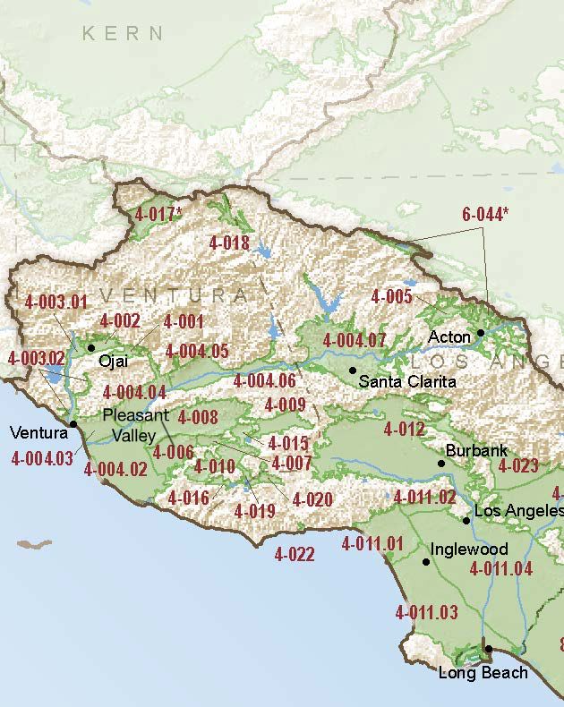
Pleasant Valley
Statistics
- Basin Name
- Pleasant Valley
- Basin Number
- 4-006
- SGMA Basin Priority
- High
- Critically Overdrafted
- Yes
- Hydrologic Region Name
- South Coast
- Counties
- Ventura
At-A-Glance
Located in California’s South Coast hydrologic region, the Pleasant Valley is 19,840 acres in size. This High priority basin is home to an estimated 66,391 people (2010 value)]. It has approximately 289 wells, of which approximately 9 are water supply wells. Groundwater accounts for approximately 71 percent of the basin’s water supply.

Basin Notes
2003: Bulletin 118 basin description
2014: CASGEM basin prioritization: High. Comments: PC ‐ Discharge of poor quality GW from dewatering wells and effluent discharge from the wastewater treatment facility into the Arroyo Simi have led to rising water levels inthe basin along with higher TDS and Chloride levels. 2016: Ranked as basin in critical overdraft.
2016: Basin boundary modification granted with Las Posas (4-008) and Oxnard (4-004.02) subbasins. Scope “minor” per Bulletin 118

Revised basin boundary description
2018: Basin prioritization: high. Comments on groundwater levels, salt intrusion, subsidence:
- Groundwater level – CASGEM/WDL/GWIDS: Longterm hydrographs show groundwater level decline. Source: DWR 2) The 2016 Annual GW Conditions Report states that there is long-term overdraft for several decades in the Pleasant Valley groundwater basin.
- Salt intrusion – 1) Although groundwater levels in the Oxnard Plain area (Mound, Oxnard, Santa Paula, Pleasant Valley, & Las Posas Valley) have been relatively stable or have shown an increasing trend, in the coastal regions this stability is largely due to seawater intrusion and results in water of unusable quality replacing high quality groundwater. Rising groundwater levels in the Las Posas Valley are a result of active management to increase groundwater recharge beneath the Arroyo Las Posas. Seawater intrusion began in the Oxnard Plain area by 1930s and was widespread as early as the 1940s. Changes in groundwater management, including pumping reductions, shifting of pumping locations, construction of the Freeman Diversion, and the operation of the Pumping Trough and Pleasant Valley pipeline systems have significantly reduced seawater intrusion, but seawater intrusion conditions persist. Source: Long Term Operation EIS, Chapter 7, U.S. Bureau of Reclamation (USBR)
- Subsidence – 1) “Steady increase in water use has resulted in seawater intrusion, inter-aquifer flow, land subsidence, and ground-water contamination.” Source: USGS WRI Report 2002-4136. Misc – Indirect evidence of subsidence related to groundwater withdrawal, groundwater level declines greater than 30m, subsurface collapse of well casings, and repeated re-leveling of irrigated fields.
2018: Final Basin Prioritization: Basin status remains unchanged at high priority.
2020: Fox Canyon Groundwater Management Agency submitted a Groundwater Sustainability Plan to the Department of Water Resources (DWR).
2021: GSP approved by DWR
