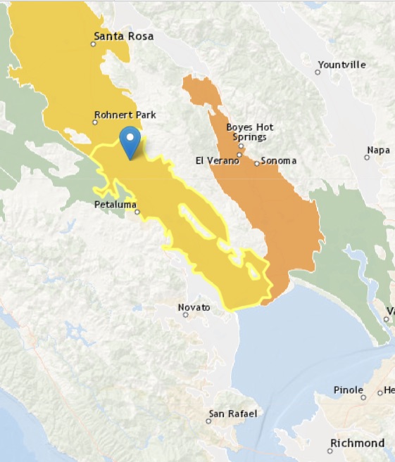
Petaluma Valley
Statistics
- Basin Name
- Petaluma Valley
- Basin Number
- 2-001
- SGMA Basin Priority
- Medium
- Critically Overdrafted
- No
- Hydrologic Region Name
- San Francisco Bay
- Counties
- Marin, Sonoma
Basin Notes
2003: Bulletin 118 basin description
2014: Basin Prioritization note: Widespread and serious nitrate contamination. Potential for seawater intrusion in tidal reaches. Increasing MTBE contamination.
2018: Basin boundary modification request with Wilson Grove Formation Highlands 1-059.
2019: Basin boundary modification approved. Per DWR: It “would revise a portion of the existing shared boundary between the Petaluma Valley basin and the Wilson Grove Formation Highlands basin. The revision would shift a portion of the shared boundary so the vast majority of the City of Petaluma is within the Petaluma Valley basin.”
Phase 2 Draft basin priority: Medium.
2022: January 22 – GSP submitted to DWR
2023: January 26 – GSP approved by DWR
At-A-Glance
California Water Library Documents About This Basin
Statement of Findings regarding the Approval of the Petaluma Valley Basin Groundwater Sustainability Plan
California Department of Water Resources (DWR) | January 26th, 2023
Petaluma Valley Groundwater Sustainability Plan
Petaluma Valley Groundwater Sustainability Agency | December 8th, 2021
Due to size, this file has been divided Part 1, Part 2, Part 3, Part 4, Part 5, Part 6, Part 7
Petaluma Valley Historical Hydrology and Ecology Study
San Francisco Estuary Institute (SFEI) | March 1st, 2018
This study examines the historical hydrology and ecology of the Petaluma River watershed prior to major Euro-American modification, and analyzes landscape changes over th
Geohydrological Characterization, Water-Chemistry, and Ground-Water Flow Simulation Model of the Sonoma Valley Area, Sonoma County, California
U.S. Geological Survey (USGS) | December 14th, 2006
Sonoma County is in the northern part of the greater San Francisco Bay region, an area of Northern California that has experienced rapid population growth and accelerated
Geology and Ground Water in the Santa Rosa and Petaluma Valley Areas, Sonoma County, California
U.S. Geological Survey (USGS) | January 31st, 1958