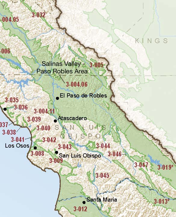
Salinas Valley – Paso Robles Area
Statistics
- Basin Name
- Salinas Valley – Paso Robles Area
- Basin Number
- 3-004.06
- SGMA Basin Priority
- High
- Critically Overdrafted
- Yes
- Hydrologic Region Name
- Central Coast
- Counties
- San Luis Obispo
- Adjacent Basins
-
Salinas Valley - Atascadero Area 3-004.11, Cholame Valley 3-005, Carrizo Plain 3-019, Salinas Valley - Upper Valley Aquifer 3-004.05,
Basin Notes
2003: Bulletin 118 basin description
2014: Basin priority high. Comment: Nitrate and TDS impacts and county ordinance banning further residential development in the basin.
Before the Well Runs Dry: Improving the Linkage Between Groundwater and Land Use Planning, Paso Robles case study, Stanford University, April 2014
Steinbeck Vineyards v. County of San Luis Obispo et al “The Quiet Title” case
2016: Basin boundary modification request: creating the Atascadero subbasin approved. The Atascadero Area Subbasin is not subject to critical conditions of overdraft. – Bulletin 118 Interim Update A further request for a change to the Upper Valley subbasin 3-004.05 is pending. Revised basin boundary description
2018: Draft basin prioritization comments –
- CRITICAL OVERDRAFT 2016 Source: DWR 1) CASGEM/WDL/GWIDS: Longterm hydrographs show groundwater level decline. Source: DWR 2) The Paso Robles groundwater subbasin supplies water for 29 percent of the population and an estimated 40 percent of the agricultural production of San Luis Obispo County. Groundwater levels in the basin have been dropping rapidly in recent years, with many areas experiencing groundwater level declines of more than 70 feet. – Central Coast Groundwater: Seawater Intrusion and other Issues, California Water Foundation, August 4, 2014
- Subsidence: 1) There don’t appear to be continuous GPS sites in the valley to access whether or not subsidence is still occuring. Source: USGS; submitted via email to DWR, 10/21/2016 – Subsidence has been documented in Paso Robles: 2) It is the current belief of the county and locals that subsidence is active. Source: 2015 County of San Luis Obispo Sustainable GW Proposal
Quiet Title: SLO County claims a victory in ongoing legal battle with landowners over water rights, Tribune/San Luis Obispo.com, 9/26/18
Landowners victorious in North County water trial, Cal Coast News, 10/1/18
2019: Approved basin modification revised the western external boundary based on arguments that a local fault and geologic contacts act as hydrologic barriers. Basin priority status remained high, as did classification of critical overdraft.
2020: January 30 – Groundwater Sustainability Plan (GSP) jointly filed with the Department of Water Resources (DWR) by cooperating GSAs of the County of San Luis Obispo, Shandon San Juan Water District, City of Paso Robles and San Miguel Community Services District
2022: January 21 – Groundwater Sustainability Plan (GSP) found incomplete by Department of Water Resources (DWR)
July 19 — Revised GSP submitted to DWR.
2023: GSP approved by DWR
At-A-Glance
California Water Library Documents About This Basin
Application of Hydrologic Simulation Program—FORTRAN (HSPF) as Part of an Integrated Hydrologic Model for the Salinas Valley, California
U.S. Geological Survey (USGS) | April 8th, 2025
The U.S. Geological Survey (USGS), in cooperation with the Monterey County Water Resources Agency, conducted studies to help evaluate the surface-water and grou
Salinas Valley Integrated Hydrologic and Reservoir Operations Models, Monterey and San Luis Obispo Counties, California
Monterey County Resources Agency (MCRA) | April 5th, 2025
To evaluate the challenging water management issues in the Salinas Valley, the U.S. Geological Survey, Monterey County Water Resource Agency, and the Salina
Establishing ecological thresholds and targets for groundwater management
Nature Portfolio (Springer Nature) | April 3rd, 2024
Groundwater is critical for many ecosystems, yet groundwater requirements for dependent ecosystems are rarely accounted for during water and conservation planning. Here w
LandFlex Program’s Guidelines
California Department of Water Resources (DWR) | December 8th, 2022
LandFlex is a program that will provide $25 million in block grants to local government agencies to grant to farmers who limit agricultural water use. Local government ag
Paso Robles Subbasin Groundwater Sustainability Plan (Revised)
Paso Robles Subbasin Groundwater Sustainability Agencies | June 13th, 2022
This Groundwater Sustainability Plan (GSP) fulfills the requirements of the Sustainable Groundwater Management Act (SGMA) for the Paso Robles Subbasin of the Salinas Vall
Linkages between land-use change and groundwater management foster long-term resilience of water supply in California
Journal of Hydrology: Regional Studies (Elsevier) | March 9th, 2022
Study Region: We created a 270-m coupled model of land-use and groundwater conditions, LUCAS-W[ater], for California’s Central Coast. This groundwater-dependent region
Statement of Findings regarding the Determination of Incomplete Status of the Salinas Valley - Paso Robles Area Subbasin Groundwater Sustainability Plan
California Department of Water Resources (DWR) | January 21st, 2022
The Department of Water Resources (Department) is required to evaluate whether a submitted groundwater sustainability plan (GSP or Plan) conforms to specific requirements
The Economic Impact on the Local Economy of Irrigated Agriculture in the Paso Robles Area and Potential Impacts of the Sustainable Groundwater Management Act
California Polytechnic State University, San Luis Obispo (CSU) | August 26th, 2020
The purpose of this study is to analyze the economic impact of the agricultural and wine industry within the Paso Robles Subbasin and AVA and San Luis Obispo County and t
Paso Robles Subbasin Groundwater Sustainability Plan
Paso Robles Subbasin Cooperative Committee | November 13th, 2019
A multi-isotope (B, Sr, O, H, and C) and age dating (3H–3He and14C) study of groundwater from Salinas Valley, California: Hydrochemistry, dynamics, and contamination processes
American Geophysical Union (AGU) | January 31st, 2002
The chemical and isotope (11B/10B, 87Sr/86Sr, 18O/16O, 2H/H, 13C/12C, 14C, and 3He/3H) compositions of groundwater from the upper aquifer system of the Salinas Valley in
Bulletin 118: California's Groundwater (1980)
California Department of Water Resources (DWR) | January 1st, 1980
Ground water management is a major issue in California. The Governor's Commission to Review California Water Rights Law, in its December 1978 report, recommends a new g
Bulletin No. 39-58, Water Supply Conditions in Southern California during 1957-1958, Volume II, Precipitation and Water Level Data, Central Coastal and Los Angeles Regions
California Department of Water Resources (DWR) | August 1st, 1960
Bulletin No. 39-57, Water Supply Conditions in Southern California during 1956-1957, Volume II, Precipitation and Water Level Data Central Coastal and Los Angeles Regions
California Department of Water Resources (DWR) | June 16th, 1958
Bulletin No. 39-57 Volume I Bulletin No. 39-57 Volume III Bulletin No. 39-57 Volume IV