 Subsidence of land surfaces has increasingly become a greater concern around the world as groundwater has continued to be depleted due to increase water demand while surface water depletion means that populations increasingly look to use subsurface water.
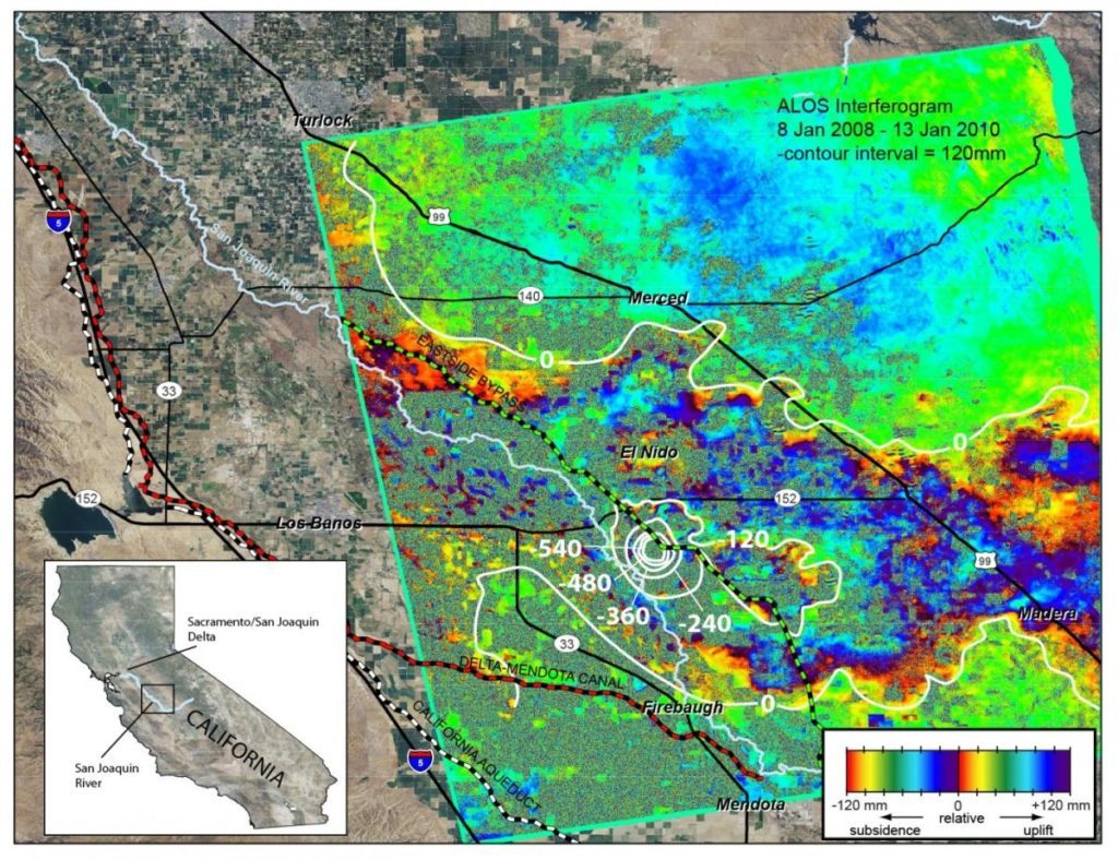
The lowering of Earth’s land surfaces promises to be a major problem for urban and rural regions and mapping these threats accurately may prove important to plan, prevent, and minimize this threat.
Using a literature review and spatial analysis, it is evident that some 34 countries are at major risk in the coming decades for major subsidence of their land surface. In particular, a recent mapping effort that looks at every 30 arc seconds resolution across the globe identified that very flat areas with unconsolidated sediments accumulated in alluvial basins or coastal plains are the most vulnerable.