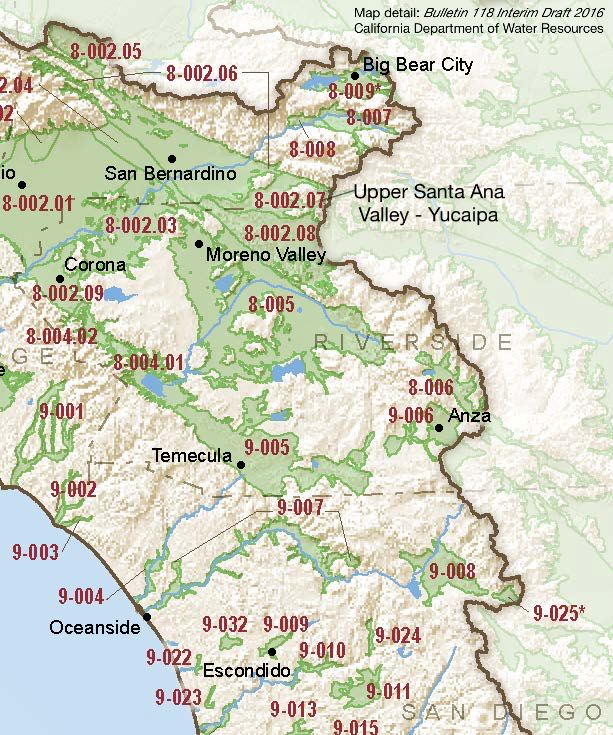
Upper Santa Ana Valley – Yucaipa
Statistics
- Basin Name
- Upper Santa Ana Valley – Yucaipa
- Basin Number
- 8-002.07
- SGMA Basin Priority
- High
- Critically Overdrafted
- No
- Hydrologic Region Name
- South Coast
- Counties
- San Bernardino
Basin Notes
2003: Bulletin 118 basin description
2014: CASGEM prioritization – medium. Comments: Overdraft. Documented impacts of nitrates and sulfates. (B‐118)
2016: basin boundary modification with Bunker Hill 8-002.06, Rialto-Colton 8-002.04, and Riverside-Arlington 8-002.03 Revised basin boundary description Jurisdictional boundary modification request by Yucaipa Valley Water District incomplete.
2018: Draft basin priority – high. Comments. 1) CASGEM/WDL/GWIDS: Longterm hydrographs show groundwater level decline. Source: DWR 2) See Final Phase 1 Report Common Ground Memorandum, San Timoteo Watershed Management Program,San Timoteo Watershed Management Authority / Wildermuth Environmental, Inc., 2002
Final Basin Prioritization: changed from Medium to High.
2022: January 27 — GSP submitted to DWR
2024: January 18 – GSP approved by DWR
At-A-Glance
California Water Library Documents About This Basin
Effect of passive integrated transponder tag size on survival, tag loss, and growth of Santa Ana Sucker
American Fisheries Society (AFS) | December 30th, 2025
The Santa Ana Sucker Pantosteus santaanae is endemic to southern California and is listed as threatened under the U.S. Endangered Species Act. Seasonal limitations on con
Final Groundwater Sustainability Plan for the Yucaipa Groundwater Subbasin
San Bernardino Valley Municipal Water District | January 27th, 2022
The Yucaipa Groundwater Sustainability Agency (GSA), acting as the GSA for the Yucaipa Subbasin (Plan Area, Subbasin), developed this Groundwater Sustainability Plan (GS
Hydrology of the Yucaipa Groundwater Subbasin: Characterization and Integrated Numerical Model, San Bernardino and Riverside Counties, California
U.S. Geological Survey (USGS) | January 26th, 2022
Water management in the Santa Ana River watershed in San Bernardino and Riverside Counties in southern California is a complex task with various water purveyors navigatin
Geology and Hydrogeology of the Yucaipa Groundwater Subbasin, San Bernardino and Riverside Counties, California
U.S. Geological Survey (USGS) | January 19th, 2022
The Yucaipa groundwater subbasin (referred to in this report as the Yucaipa subbasin) is located about 75 miles (mi) east of of Los Angeles and about 12 mi southeast of t
Bulletin No. 39-W, Southern California Area Investigation, Ground Water Levels and Precipitation Records in Los Angeles, San Gabriel and Santa Ana River Basins and Antelope Valley and Water Supply Summary for Southern Portion of California 1954
California Department of Water Resources (DWR) | June 1st, 1956
Bulletin No. 39-U, Southern California Area Investigation, Ground Water Levels and Precipitation Records in Los Angeles, San Gabriel, and Santa Ana River Basins and Antelope Valley and Water Supply Summary for Southern Portion of California 1952
California Department of Water Resources (DWR) | August 1st, 1955
Bulletin No. 39-V, Southern California Area Investigation, Ground Water Levels and Precipitation Records in Los Angeles, San Gabriel, and Santa Ana River Basins and Antelope Valley and Water Supply Summary for Southern Portion of California 1953
California Department of Water Resources (DWR) | August 1st, 1955
Bulletin No. 39-T, Southern California Area Investigation, Ground Water Levels and Precipitation Records in Los Angeles, San Gabriel, and Santa Ana River Basins and Antelope Valley, Water Supply Summary for Southern Portion of California 1951
California Department of Water Resources (DWR) | June 1st, 1955
Bulletin No. 39-S, Southern California Area Investigation, Ground Water Levels and Precipitation Records in Los angeles, San Gabriel, and Santa Ana River Basins and Antelope Valley and Water Supply Summary for Southern Portion of California 1950
California Department of Water Resources (DWR) | April 1st, 1955
Bulletin No. 39-R, Southern California Area Investigation, Ground Water Levels and Precipitation Records in Los Angeles, San Gabriel, and Santa Ana River Basins and Antelope Valley
California Department of Water Resources (DWR) | July 1st, 1954
Bulletin No. 39-Q, South Coastal Basin Investigation, Ground Water Levels and Precipitation Records in Los Angeles, San Gabriel and Santa Ana River Basins and Antelope Valley and Water Supply Summary for Southern Portion of California 1948
California Department of Water Resources (DWR) | July 1st, 1953
Wells of Southern California
Scientific American | March 22nd, 1902
In the Series of Water Supply Irrigation Papers, the United States Geological Survey has in press, but not yet published, the “Wells of Southern California" (Nos. 59