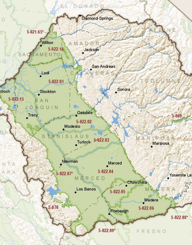
San Joaquin Valley – Madera
Statistics
- Basin Name
- San Joaquin Valley – Madera
- Basin Number
- 5-022.06
- SGMA Basin Priority
- High
- Critically Overdrafted
- Yes
- Hydrologic Region Name
- San Joaquin River
- Counties
- Madera
At-A-Glance
Located in California’s San Joaquin River hydrologic region, the San Joaquin Valley – Madera subbasin is 347,667.39 acres in size. This High priority basin is home to an estimated 107,010 people (2010 value). It has approximately 7231 wells, of which approximately 118 are water supply wells. Groundwater accounts for approximately 98 percent of the basin’s water supply.

Basin Notes
2003: Bulletin 118 basin description
2014: CASGEM basin prioritization – high. Comments: subsidence, critical overdraft, water quality degradation
2016: Basin boundary modification approved with Chowchilla 5-022.05 and Delta Mendota 5-022.07 Revised basin boundaries description
2018: Draft basin priority – high. Groundwater level and subsidence comments:
- CRITICAL OVERDRAFT. Source: DWR 1) CASGEM/WDL/GWIDS: Longterm hydrographs show groundwater level decline. Source: DWR 2) Overdraft was estimated to average 143,000 AF/year over the period from 1980-2011. Future overdraft (2014 and beyond) is estimated to be 259,000 AF/year. The increase in overdraft can be attributed primarily to increased cropping, maturation of existing tree crops, and impacts from the San Joaquin River Restoration. Source: Madera Regional GMP-Final.2014.12.09.pdf
- Sources : 1) Current Land Subsidence in the San Joaquin Valley, USGS; 2) 2014 – Land Subsidence from Groundwater Use in California, California Water Foundation / James W. Borchers / Michael Carpenter, Luhdorff & Salmanini, April 2014; 3) Progress Report: Subsidence in the Central Valley, California, Jet Propulsion Laboratory, California Institute of Technology, NASA 2015-16; 4) San Joaquin River Restoration Program / US Bureau of Reclamation monitoring Groundwater Quality in the Shallow Aquifers of the Madera– Chowchilla and Kings Subbasins, San Joaquin Valley, California, U.S. Geological Survey, January 2018
