San Joaquin Valley – Kings
Statistics
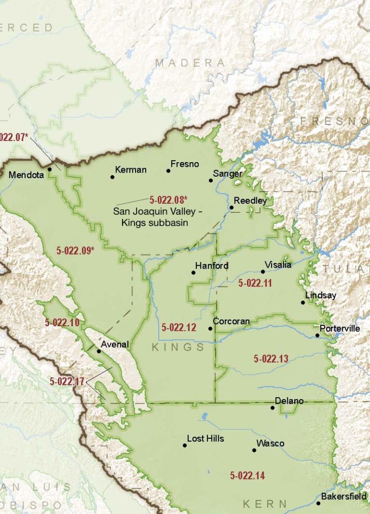
- Basin Name
- San Joaquin Valley – Kings
- Basin Number
- 5-022.08
- SGMA Basin Priority
- High
- Critically Overdrafted
- Yes
- Hydrologic Region Name
- Tulare Lake
- Counties
- Fresno, Kings
Basin Notes
2003: Bulletin 118 basin description
2014: CASGEM basin prioritization – high
2016: Basin boundary modifications approved with the Madera 5-022.06, Westside 5-022.09, Delta-Mendota 5-022.07, and Tracy 5-022.15 sub-basins
2018: Draft priority – high. Groundwater level and salt intrusion comments:
- CRITICAL OVERDRAFT 1) CASGEM/WDL/GWIDS: Longterm hydrographs show groundwater level decline. Source: DWR 2) The region faces many water management challenges including groundwater overdraft, surface water shortages in dry years, and groundwater quality problems in certain areas. Groundwater overdraft is generally considered the largest regional problem with the current plan area overdraft estimated to be 100,000 to 150,000 AF/year. The longterm decline in groundwater storage will be significant if current water management strategies are maintained. Correcting the overdraft through regional efforts will help lead to overall maintenance and improvement in the quantity, quality and cost of development of groundwater resources in the region.
- Sources: 1) Current Land Subsidence in the San Joaquin Valley, USGS; 2) 2014 – Land Subsidence from Groundwater Use in California, California Water Foundation / James W. Borchers / Michael Carpenter, Luhdorff & Salmanini, April 2014; 3) Progress Report: Subsidence in the Central Valley, California, Jet Propulsion Laboratory, California Institute of Technology, NASA 2015-16
Shallow Aquifers of the Madera– Chowchilla and Kings Subbasins, San Joaquin Valley, California, U.S. Geological Survey, January 2018
2019: Basin boundary modification. Per DWR: It “revises the northeastern external boundary of the Kings subbasin to more accurately follow mapped contacts between alluvial units and non- alluvial geologic units. The requesting agency provided sufficient scientific rationale and utilized a qualified map for the boundary revision.” Phase 2 draft basin priority: high December 20, 2019 – Coordination agreement between Central Kings, Kings River East, North Fork Kings, James Groundwater, North Kings and South Kings GSAs
2020: January 28th –
- Central Kings GSA Groundwater Sustainability Plan (GSP) submitted to the Department of Water Resources
- North Fork Kings GSP submitted to DWR
- South Kings GSA‘s GSP submitted to DWR
- McMullin Area GSA‘s GSP submitted to DWR
- Kings River East GSP submitted to DWR
- North Kings GSP submitted to DWR
- James GSA GSP submitted to DWR
2021: December 9 – DWR writes collective GSAs warning that preliminary review of the GSPs spotted deficiencies that will need addressing
2022: Subbasin GSAs collectively notified that their GSPs are “incomplete” because of failure to to set satisfactory sustainable management criteria for chronic lowering of groundwater levels, subsidence avoidance, damage to interconnected surface waters and impacts on water quality. The seven cooperating GSAs given until July 27, 2022 to submit revised GSPs
July 14 – North Fork Kings approves revised GSP.
July 22 – James GSA submits a revised GSP. No signature by preparing engineer.
July 27 – Revised North Fork Kings GSP submitted to DWR.
July 27 – Revised Central Kings GSP submitted to DWR.
July 28 – Kings River East revised GSP submitted to DWR.
2023: August 4 — GSPs approved by DWR
At-A-Glance
California Water Library Documents About This Basin
Decadal Shifts in Groundwater Age Detected by Environmental Tracers Across California
American Geophysical Union (AGU) | March 23rd, 2026
Groundwater age tells us how long water has been underground since it last infiltrated the land surface. Monitoring changes in groundwater age helps identify aquifer stre
San Joaquin Valley Conveyance Study
California Department of Water Resources (DWR) | November 24th, 2025
This San Joaquin Valley Conveyance Study analyzes water conveyance needs in the San Joaquin Valley (Figure ES-1). The purpose of this study is to: •Describe the impa
Assessing Causes and Consequences of Winter Surface Water Dynamics in California's Central Valley Using Satellite Remote Sensing
Wiley Online Library | June 3rd, 2025
California's Central Valley is increasingly vulnerable to winter floods. A comprehensive spatial baseline of flood extents is critical for inundation analyses that can en
Quantification of record-breaking subsidence in California’s San Joaquin Valley
Nature Portfolio (Springer Nature) | November 19th, 2024
Drought, water management, and agricultural livelihoods: Understanding human-ecological system management and livelihood strategies of farmer’s in rural California
Elsevier | July 11th, 2024
CV-SALTS Groundwater Sustainability Plan Data Integration Report Integrated Scope of Work - Task 5.3 (Draft)
Central Valley Salinity Alternatives for Long-Term Sustainability (CV-SALTS) | June 20th, 2024
The purpose of Prioritization & Optimization (P&O) Study Task 5.3 (Information Extraction from Groundwater Sustainability Plans [GSP]) is to extract and organize
Replenishing Groundwater in the San Joaquin Valley: 2024 Update
Public Policy Institute of California (PPIC) | June 6th, 2024
Strategies to replenish groundwater basins—long used in some areas of the San Joaquin Valley—have increasingly come into focus as the region seeks to bring its overd
Status of Water Quality in Groundwater Resources Used for Drinking-Water Supply in the Southeastern San Joaquin Valley, 2013–15: California GAMA Priority Basin Project
U.S. Geological Survey (USGS) | April 25th, 2024
The California Groundwater Ambient Monitoring and Assessment Program Priority Basin Project (GAMA-PBP) investigated water quality of groundwater resources used for drinki
Groundwater sustainability and land subsidence in California’s Central Valley
Water (MDPI) | April 22nd, 2024
The Central Valley of California is one of the most prolific agricultural regions in the world. Agriculture is reliant on the conjunctive use of surface-water and groundw
CV-SALTS Groundwater Sustainability Plan Data Collection - Pilot Study Results
Central Valley Salinity Alternatives for Long-Term Sustainability (CV-SALTS) | February 1st, 2024
The purpose of Prioritization & Optimization (P&O) Study Task 5.3 (Information Extraction from Groundwater Sustainability Plans [GSP]) is to extract and organize relevan
Thousands of domestic and public supply wells face failure despite groundwater sustainability reform in California’s Central Valley
Nature Portfolio (Springer Nature) | September 8th, 2023
Statement of Findings regarding the Approval of the San Joaquin Valley – Kings Subbasin Groundwater Sustainability Plan
California Department of Water Resources (DWR) | August 4th, 2023
A simmering revolt against groundwater cutbacks in California
Stanford University | December 14th, 2022
In 2014, California legislators, focused on groundwater’s accelerating decline during a prolonged drought, passed the Sustainable Groundwater Management Act. Its impera
LandFlex Program’s Guidelines
California Department of Water Resources (DWR) | December 8th, 2022
LandFlex is a program that will provide $25 million in block grants to local government agencies to grant to farmers who limit agricultural water use. Local government ag
Modeling the dynamic penetration depth of post-1950s water in unconfined aquifers using environmental tracers: Central Valley, California
Journal of Hydrology (Elsevier) | December 5th, 2022
The penetration depth of post-1950s recharge (D-1950) in aquifers is a marker that is frequently used to identify groundwater that is susceptible to anthropogenic contami
Subsurface water flux in California's Central Valley and its source watershed from space geodesy
American Geophysical Union (AGU) | September 29th, 2022
We combine measurements from Global Positioning System positioning and Gravity Recovery and Climate Experiment gravity to infer change in water components in Central Vall
Central Kings Groundwater Sustainability Agency Groundwater Sustainability Plan (Revised)
Central Kings Groundwater Sustainability Agency (CKGSA) | July 13th, 2022
South Kings Groundwater Sustainability Agency Groundwater Sustainability Plan (Revised)
South Kings Groundwater Sustainability Agency | July 13th, 2022
McMullin Area Groundwater Sustainability Agency Groundwater Sustainability Plan (Revised)
McMullin Area Groundwater Sustainability Agency (MAGSA) | July 6th, 2022
Kings River East GSA Groundwater Sustainability Plan (Revised)
Kings River East Groundwater Sustainability Agency (KREGSA) | July 5th, 2022