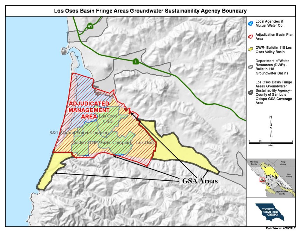
Los Osos Valley (subdivided in 2019 to two subbasins: Los Osos 3-008.01 and Warden Creek 3-008.02)
Statistics
- Basin Name
- Los Osos Valley (subdivided in 2019 to two subbasins: Los Osos 3-008.01 and Warden Creek 3-008.02)
- Basin Number
- 3-008
- SGMA Basin Priority
- High
- Critically Overdrafted
- Yes
- Hydrologic Region Name
- Central Coast
- Counties
- San Luis Obispo
- Adjacent Basins
At-A-Glance

Basin Notes
2003: Bulletin 118 basin description
2015: Stipulated Judgment and Updated Basin Plan for the Los Osos Groundwater (Basin Plan) approved by the San Luis Obispo Superior Court on October 14,
62% of the basin’s 7,008 acres are adjudicated. Los Osos Basin Annual Report 01/01/2017 – 12/31/2017 Un-adjudicated portions of the basin are subject to SGMA.
2016: Basin prioritization – Critical overdraft. Source: DWR 1) CASGEM/WDL/GWIDS: Longterm hydrographs show groundwater level decline. Source: DWR 2) The primary constraint on water availability in the Los Osos Valley Groundwater Basin is deteriorating water quality due to sea water intrusion and nitrate contamination. Source: L_Appendix_SLOGWBasins.pdf Salt intrusion – 1) Priority Factor 6 ? Basins with Coast-Known Seawater Intrusion and/or Nitrate Contamination: This factor relates to the target constituents an SNMP seeks to address ? salt and nitrates. The following basins are Coast-Known to have seawater intrusion and/or nitrate issues: Morro and Chorro Valley, Los Osos Valley, North Coast (Santa Rosa and San Simeon Valley). Source: SLO-IRWMP_O_Appendix.pdf 2) Los Osos CSD: The district has suffered from a high turnover of general managers in recent years. It is also must deal with saltwater intrusion into the aquifers beneath the town. Source: SLO County special district, CSD election results November 2016_The Tribune.pdf 3) In order to control seawater intrusion in the Basin, the Purveyors and other groundwater users need to reduce their production from the Lower Aquifer in the Western Area. That action will allow freshwater levels to rise, thereby preventing further seawater intrusion and pushing the freshwater-seawater interface seaward and away from the Los Osos community. Source: Los Osos Basin Plan-2015.pdf 4) The Basin Plan established two methods for measuring progress in management of seawater intrusion (ISJ Group, 2015): one based on comparing annual groundwater extractions with the sustainable yield of the basin as calculated by the basin numerical groundwater model, and one based on evaluating water level and water quality data from the LOBP Groundwater Monitoring Program. …The Chloride Metric is defined as the weighted average concentration of chlorides in four key Lower Aquifer wells. One key well (LA10) is within the historical path of seawater intrusion (Cleath & Associates, 2005). Reduction in pumping from the Lower Aquifer should result in measurable declines in chloride concentrations at this well, as the hydraulic head in the Lower Aquifer increases and the hydraulic gradient toward land decreases or reversed. The LOBP Groundwater Monitoring Program schedule for measuring the Chloride metric is in the Spring and Fall. There are also three key wells on the perimeter of the seawater intrusion front (LA8, LA11, and LA12). Source: Los Osos-2015 Annual Report
2018: Basin boundary modification request
