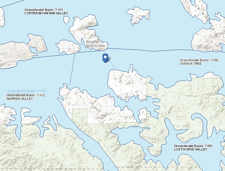
Joshua Tree
Statistics
- Basin Name
- Joshua Tree
- Basin Number
- 7-062
- SGMA Basin Priority
- Very Low
- Critically Overdrafted
- No
- Hydrologic Region Name
- Colorado River
- Counties
- San Bernardino
- Adjacent Basins
Basin Notes
2003: Bulletin 118 basin description
2015: National Park Service: Joshua Tree National Park: A History of Preserving the Desert by Lary M. Dilsaver
2017: Desert Groundwater at Stake as Joshua Tree Pumping Plan Moves Forward, Press Enterprise
2019: Basin boundary modification aligns the western boundary of the Joshua Tree basin with the geographic location of the Yucca barrier, a feature that affects groundwater flow.” Phase 2 draft basin priority: very low
At-A-Glance

California Water Library Documents About This Basin
Mojave Region Functionally Equivalent Storm Water Resources Plan
Mojave Water Agency (MWA) | October 4th, 2017
The State of California now recognizes the importance of incorporating storm water as a potential resource in a region’s water portfolio. Historically, storm water was
Regional water table (2014) in the Mojave River and Morongo Groundwater Basins, southwestern Mojave Desert, California
U.S. Geological Survey (USGS) | June 28th, 2016
Data for static water-levels measured in about 610 wells during March-April 2014 by the U.S. Geological Survey (USGS), the Mojave Water Agency (MWA), and other local wate
Mapping selected trace elements and major ions, 2000-2012, Mojave River and Morongo Groundwater Basins, Southwestern Mojave Desert, San Bernardino County, California
U.S. Geological Survey (USGS) | July 1st, 2015
The population of the Mojave River and Morongo groundwater basins has grown rapidly during the last several decades, increasing from an estimated population of almost 273
Joshua Tree National Park: A History of Preserving the Desert
National Park Service (NPS) | March 16th, 2015
Final Mojave Region Integrated Regional Water Management Plan
Mojave Water Agency (MWA) | June 1st, 2014
Evaluation of Geohydrologic Framework, Recharge Estimates, and Ground-Water Flow of the Joshua Tree Area, San Bernardino County, California
U.S. Geological Survey (USGS) | July 1st, 2004
Regional water table (2002) and water-level changes in the Mojave River and the Morongo ground-water basins, Southwestern Mojave Desert, California
U.S. Geological Survey (USGS) | July 1st, 2004
Regional Water Table (2000) and Ground-Water-Level Changes in the Mojave River and the Morongo Ground-Water Basins, Southwestern Mojave Desert, California
U.S. Geological Survey (USGS) | July 1st, 2003
Detection and Measurement of Land Subsidence Using Interferometric Synthetic Aperture Radar and Global Positioning System, San Bernardino County, Mojave Desert, California
U.S. Geological Survey (USGS) | July 1st, 2003
Regional water table (1998) and ground-water-level changes in the Mojave River and the Morongo ground-water basins, San Bernardino County, California
U.S. Geological Survey (USGS) | July 1st, 2000
Regional water table (1994) and water-level changes in the Morongo Basin, San Bernardino County, California
U.S. Geological Survey (USGS) | July 1st, 1995
The Morongo Basin is in the Mojave Desert region of southern California, about 100 mi east of Los Angeles. Ground water is virtually the sole source of water in the Moro
County of San Bernardino Hydrology Manual
San Bernardino County | August 1st, 1986
Ground-water resources of the Yucca Valley-Joshua Tree area, San Bernardino County, California
U.S. Geological Survey (USGS) | July 18th, 1972