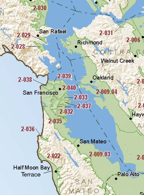
Half Moon Bay Terrace
Statistics
- Basin Name
- Half Moon Bay Terrace
- Basin Number
- 2-022
- SGMA Basin Priority
- Very Low
- Critically Overdrafted
- No
- Hydrologic Region Name
- San Francisco Bay
- Counties
- San Mateo
- Adjacent Basins
-
No items found
At-A-Glance
Located in California’s San Francisco Bay hydrologic region, the Half Moon Bay Terrace is 9189 acres in size. This Very Low priority basin is home to an estimated 19,729 people (2010 value). It has approximately 752 wells, of which approximately 12 are water supply wells. Groundwater accounts for approximately 48 percent of the basin’s water supply.

Basin Notes
2003: Bulletin 118 basin description
2018: Basin draft prioritization moved Half Moon Bay from low to high priority, subjecting it to SGMA. Salt intrusion comment:
- Based on water balance results, the Phase II study concludes the following: a) the Midcoast aquifers have a considerable groundwater surplus in above average rainfall years but can have a deficit in dry and very dry years; b) the marine terrace subareas appear to be in long-term hydrologic balance and should remain in long-term balance with a moderate increase in water extractions; c) current pumping rates have lowered the water table to near sea level during dry years, and potentially below sea level during very dry years, posing risks of saltwater intrusion; and, d) increased pumping over long periods of time, especially during drier years, will increase the amount of time that the water table falls near or below sea level; and this increases the risk of saltwater intrusion. Source: Midcoast Groundwater Phase III, San Mateo County, CA
Comment on reprioritization by the County of San Mateo, City of Half Moon Bay, and Montara Water and Sanitary District
2018 Final Basin Prioritization: Very Low Priority.
