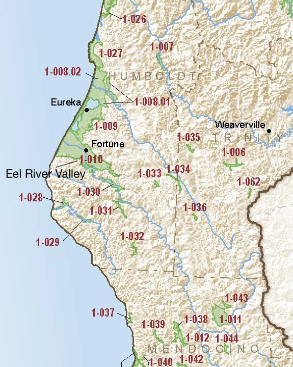
Eel River Valley
Statistics
- Basin Name
- Eel River Valley
- Basin Number
- 1-010
- SGMA Basin Priority
- Medium
- Critically Overdrafted
- No
- Hydrologic Region Name
- North Coast
- Counties
- Humboldt
- Adjacent Basins
At-A-Glance
Located in California’s North Coast hydrologic region, the Eel River Valley is 73,700 acres in size. This Medium priority basin is home to an estimated 23,384 people (2010 value). It has approximately 499 wells, of which approximately 25 are water supply wells. Groundwater accounts for approximately 96 percent of the basin’s water supply.

Basin Notes
2003: Bulletin 118 basin description
2017: Per SGMA Prioritization Dashboard:
- “GSP Alternative submitted and accepted 12/2016 states GWLs have been stable for the last 10 years. Source: Eel River GSP Alternative 2017”
- 1) Seawater Intrusion Conditions: The principal aquifers within the Basin are in good hydrologic connection with the ocean along approximately 10 miles of coastline. The western-most portion of the valley consists of a broad, low-lying coastal plain within intertidal/brackish marsh and wetlands. The tidal influence within the Eel River extends upstream of Fernbridge approximately 12 miles inland from the mouth. Source: EelRiverGWAltPlan-rpt-Final-20161230.pdf
- Chloride concentrations in excess of the 250 milligrams per liter drinking-water recommendation are reported in water from wells near the Eel River as much as 4 miles inland from the Pacific Ocean, suggesting that the source of the chloride is brackish water from the tidal reaches of the river. Source: Groundwater aquifers of the United States Coastal Basin Aquifers 1995 (HA730-B).
2018: Basin Prioritization: Medium priority.
2019: GSP alternative plan disapproved by DWR because objective management criteria had not been established for 10 years; a quantitative estimate of sustainable yield was not developed; and the GSP Alternative did not quantify the impacts of groundwater use on surface water systems and determine at what point they are significant and unreasonable. As a result of the GSP Alternative being disapproved, a GSP was developed.
2022: January 29 – Groundwater Sustainability Plan (GSP) submitted to the Department of Water Resources (DWR).
2023: October 26 – GSP approved by DWR
