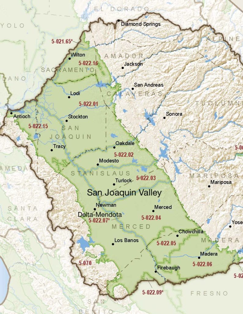
San Joaquin Valley – Delta-Mendota
Statistics
- Basin Name
- San Joaquin Valley – Delta-Mendota
- Basin Number
- 5-022.07
- SGMA Basin Priority
- High
- Critically Overdrafted
- Yes
- Hydrologic Region Name
- San Joaquin River
- Counties
- Fresno, Madera, Merced, Stanislaus
Basin Notes
2003: Bulletin 118 basin description
2014: CASGEM basin prioritization – high
2016: Boundary modification approved a boundary change with Madera subbasin 5-022.06
Revised basin boundary description
2018: Phase 2 (FINAL) Priority – High. CRITICAL OVERDRAFT.
2019: Basin boundary modification. Per DWR: It “revised a portion of the shared boundary between the Chowchilla and Delta-Mendota subbasins to align with the jurisdictional boundaries of Triangle T Water District and Clayton Water District.”
2020: January – Multiple GSPs submitted to the Department of Water Resources: San Luis & Delta Water Authority; Farmers Water District; Aliso Water District; Grassland GSA/Merced County; San Joaquin River Exchange Contractors GSP Group; Fresno County Management Areas A and B
2022: January 21 – DWR determines combined GSPs are incomplete
July 20 – revised Farmers GSP submitted to DWR
July 20 – revised San Luis and Delta Water Authority GSP submitted to DWR
July 20 – revised Grasslands GSP submitted to DWR
July 20 – revised Aliso Water District revised GSP submitted to DWR
2023: May 3 – DWR finds revised GSPs inadequate
July 31 – Twenty three GSAs of the Delta-Mendota sub basin publish a joint GSP. Press release here. Document here.
2025: April 15 – DWR working with GSAs regarding the remaining concerns identified in the updated GSP. Staff expects to produce a recommendation to the Board in late 2025.
2026: March 2 – State Water Board staff concluded a probationary designation of the Delta-Mendota Subbasin is unnecessary and recommends the Board return the subbasin to DWR’s jurisdiction
At-A-Glance
California Water Library Documents About This Basin
Decadal Shifts in Groundwater Age Detected by Environmental Tracers Across California
American Geophysical Union (AGU) | March 23rd, 2026
Groundwater age tells us how long water has been underground since it last infiltrated the land surface. Monitoring changes in groundwater age helps identify aquifer stre
Delta-Mendota Subbasin Staff Assessment
California State Water Resources Control Board (SWRCB) | March 2nd, 2026
The Delta-Mendota Subbasin (subbasin) is located in the western portion of the San Joaquin Valley, in portions of Fresno, Madera, Merced, San Joaquin, San Benito, and Sta
San Joaquin Basin Flood‑MAR Watershed Studies Upper San Joaquin Watershed Study Area Report
California Department of Water Resources (DWR) | December 3rd, 2025
The San Joaquin Basin Flood‑MAR Watershed Studies (Watershed Studies) — comprising five watershed reports for Calaveras, Stanislaus, Tuolumne, Merced and Upper San Jo
San Joaquin Basin Flood‑MAR Watershed Studies Tuolumne Watershed Study Area Report
California Department of Water Resources (DWR) | December 3rd, 2025
The San Joaquin Basin Flood‑MAR Watershed Studies (Watershed Studies) — comprising five watershed reports for Calaveras, Stanislaus, Tuolumne, Merced and Upper San Jo
San Joaquin Valley Conveyance Study
California Department of Water Resources (DWR) | November 24th, 2025
This San Joaquin Valley Conveyance Study analyzes water conveyance needs in the San Joaquin Valley (Figure ES-1). The purpose of this study is to: •Describe the impa
Assessing Causes and Consequences of Winter Surface Water Dynamics in California's Central Valley Using Satellite Remote Sensing
Wiley Online Library | June 3rd, 2025
California's Central Valley is increasingly vulnerable to winter floods. A comprehensive spatial baseline of flood extents is critical for inundation analyses that can en
CV-SALTS Preliminary Management Zone Proposal for Priority 2 Management Zones
Valley Water Collaborative | December 30th, 2024
The Nitrate Control Program is designed to achieve the following three management goals in the Central Valley Region: Goal 1 – Ensure a safe drinking water
Quantification of record-breaking subsidence in California’s San Joaquin Valley
Nature Portfolio (Springer Nature) | November 19th, 2024
San Luis National Wildlife Refuge Complex Final Comprehensive Conservation Plan and Environmental Assessment
U.S. Fish and Wildlife Service (FWS) | July 31st, 2024
This Comprehensive Conservation Plan (CCP) will guide the management of the Merced National Wildlife Refuge (NWR), San Luis NWR and Grasslands Wildlife Management Area (W
Groundwater Sustainability Plan for the Delta-Mendota Subbasin
Delta-Mendota Subbasin Coordination Committee | July 31st, 2024
1. Table of Contents 2. Executive Summary 3. Introduction 4. Plan Area 5. Basin Setting 6. Groundwater Conditions 7. Water Budget 8. Sustainability Criteria 9
CV-SALTS Groundwater Sustainability Plan Data Integration Report Integrated Scope of Work - Task 5.3 (Draft)
Central Valley Salinity Alternatives for Long-Term Sustainability (CV-SALTS) | June 20th, 2024
The purpose of Prioritization & Optimization (P&O) Study Task 5.3 (Information Extraction from Groundwater Sustainability Plans [GSP]) is to extract and organize
Replenishing Groundwater in the San Joaquin Valley: 2024 Update
Public Policy Institute of California (PPIC) | June 6th, 2024
Strategies to replenish groundwater basins—long used in some areas of the San Joaquin Valley—have increasingly come into focus as the region seeks to bring its overd
Groundwater sustainability and land subsidence in California’s Central Valley
Water (MDPI) | April 22nd, 2024
The Central Valley of California is one of the most prolific agricultural regions in the world. Agriculture is reliant on the conjunctive use of surface-water and groundw
Thousands of domestic and public supply wells face failure despite groundwater sustainability reform in California’s Central Valley
Nature Portfolio (Springer Nature) | September 8th, 2023
Statement of Findings regarding the Determination of Inadequate Status of the San Joaquin Valley – Delta-Mendota Subbasin Groundwater Sustainability Plan
California Department of Water Resources (DWR) | March 2nd, 2023
A simmering revolt against groundwater cutbacks in California
Stanford University | December 14th, 2022
In 2014, California legislators, focused on groundwater’s accelerating decline during a prolonged drought, passed the Sustainable Groundwater Management Act. Its impera
LandFlex Program’s Guidelines
California Department of Water Resources (DWR) | December 8th, 2022
LandFlex is a program that will provide $25 million in block grants to local government agencies to grant to farmers who limit agricultural water use. Local government ag
Modeling the dynamic penetration depth of post-1950s water in unconfined aquifers using environmental tracers: Central Valley, California
Journal of Hydrology (Elsevier) | December 5th, 2022
The penetration depth of post-1950s recharge (D-1950) in aquifers is a marker that is frequently used to identify groundwater that is susceptible to anthropogenic contami
Friant Water Supply Protection Association vs. Del Puerto Water District et al
Superior Court of California, County of Stanislaus | October 31st, 2022
Subsurface water flux in California's Central Valley and its source watershed from space geodesy
American Geophysical Union (AGU) | September 29th, 2022
We combine measurements from Global Positioning System positioning and Gravity Recovery and Climate Experiment gravity to infer change in water components in Central Vall