
 The Department of Water Resources’ (DWR) innovative Statewide Airborne Electromagnetic (AEM) Survey Project has now released AEM data for the entire Central Valley of California, marking a major milestone for the program.
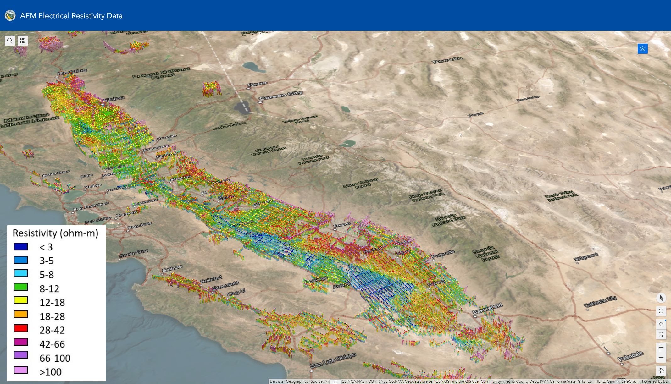
Over 11,500 line-miles of AEM data were collected within the Central Valley between December 2021 and May 2022 using this helicopter-based technology that scans the earth’s subsurface. The AEM data is published on a continual basis, and the most recent release of data from the Northern Sacramento Valley completes the data release for the entire Central Valley. This remarkable dataset provides a never-before-seen continuous view of the structure below the earth’s surface in one of the most groundwater-dependent areas of the world.