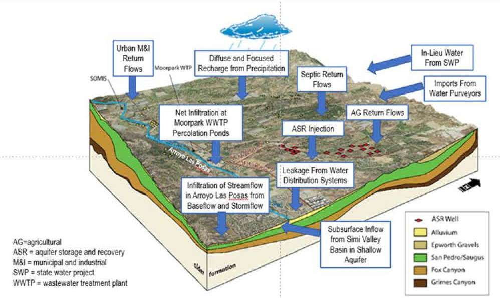
 This report documents the computer software package, Basin Characterization Model, version 8 (BCMv8)—a monthly, gridded, regional water-balance model—and provides detailed operational instructions and example applications. After several years of many applications and uses of a previous version, CA-BCM, published in 2014, the BCMv8 was refined to improve the accuracy of the water-balance components, particularly the recharge estimate, which is the most difficult to accurately assess.
The improvement of the various water-balance components targeted the actual evapotranspiration component, which, in turn, reduced the uncertainty of the recharge estimate. The improvement of this component was enabled by the availability of a national, gridded actual-evapotranspiration product from the U.S. Geological Survey that was unique in its scope to combine remotely sensed spatial variability and ground-based long-term water-balance constraints.
This dataset provided the ability to assess monthly actual evapotranspiration for 62 vegetation types and to perform regional calibration in watersheds throughout California with the objective of closing the water balance using improved estimates for each component. The refinements, including vegetation-specific evapotranspiration, enabled the development of applications that could explore various aspects of landscape disturbance, such as wildfire, forest management, or urbanization.
The improvements to BCMv8 also provided the ability to assess long-term sustainability of water resources under a variety of management applications or future climate projections.
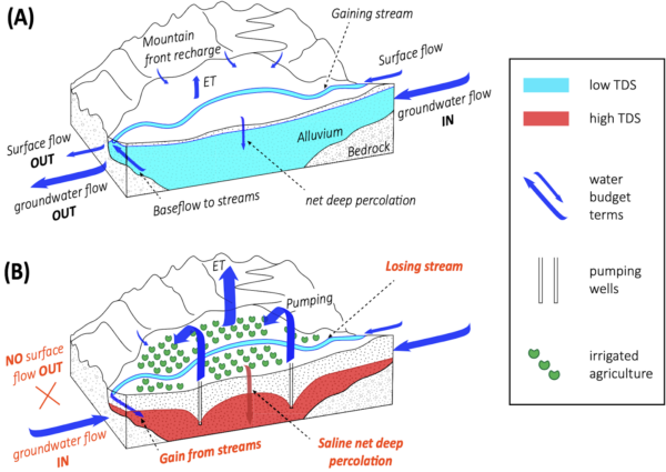 “Lower groundwater levels can prevent drainage of water and salts from a basin and increase aquifer salinity that eventually renders the groundwater unsuitable for use as drinking water or irrigation without expensive desalination. Pauloo et al. (2021) demonstrate this process for the Tulare Lake Basin (TLB) of California’s Central Valley.