Upper Santa Ana Valley – Yucaipa
Statistics
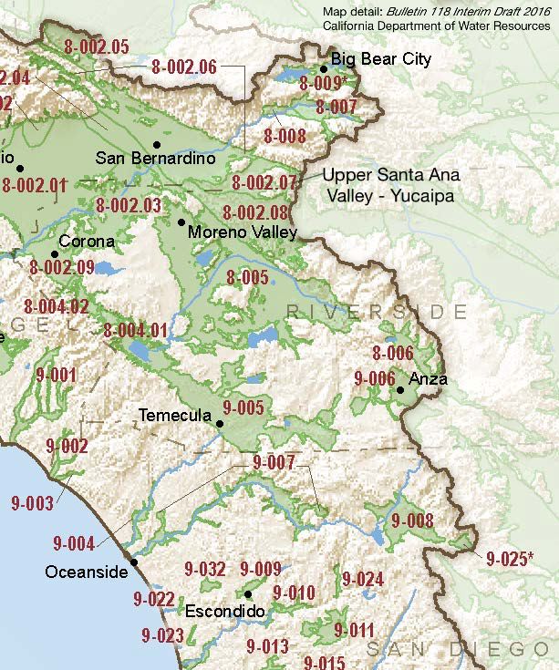
- Basin Name
- Upper Santa Ana Valley – Yucaipa
- Basin Number
- 8-002.07
- SGMA Basin Priority
- High
- Critically Overdrafted
- No
- Hydrologic Region Name
- South Coast
- Counties
- San Bernardino
At-A-Glance
Located in California’s South Coast hydrologic region, the Upper Santa Ana Valley – Yucaipa subbasin is 22,219 acres. This High priority basin is home to an estimated 56,527 people (2010 value). It has approximately 246 wells, of which approximately 37 are water supply wells. Groundwater accounts for approximately 74.98 percent of the basin’s water supply.
Basin Notes
2003: Bulletin 118 basin description
2014: CASGEM prioritization – medium. Comments: Overdraft. Documented impacts of nitrates and sulfates. (B‐118)
2016: basin boundary modification with Bunker Hill 8-002.06, Rialto-Colton 8-002.04, and Riverside-Arlington 8-002.03 Revised basin boundary description Jurisdictional boundary modification request by Yucaipa Valley Water District incomplete.
2018: Draft basin priority – high. Comments. 1) CASGEM/WDL/GWIDS: Longterm hydrographs show groundwater level decline. Source: DWR 2) See Final Phase 1 Report Common Ground Memorandum, San Timoteo Watershed Management Program,San Timoteo Watershed Management Authority / Wildermuth Environmental, Inc., 2002
Final Basin Prioritization: changed from Medium to High.
2022: January 27 — GSP submitted to DWR
2024: January 18 – GSP approved by DWR